Overview
Meridian Solar is a proposed solar farm and overhead line connection to the national grid, located north of Crowland and east of Spalding in Lincolnshire.
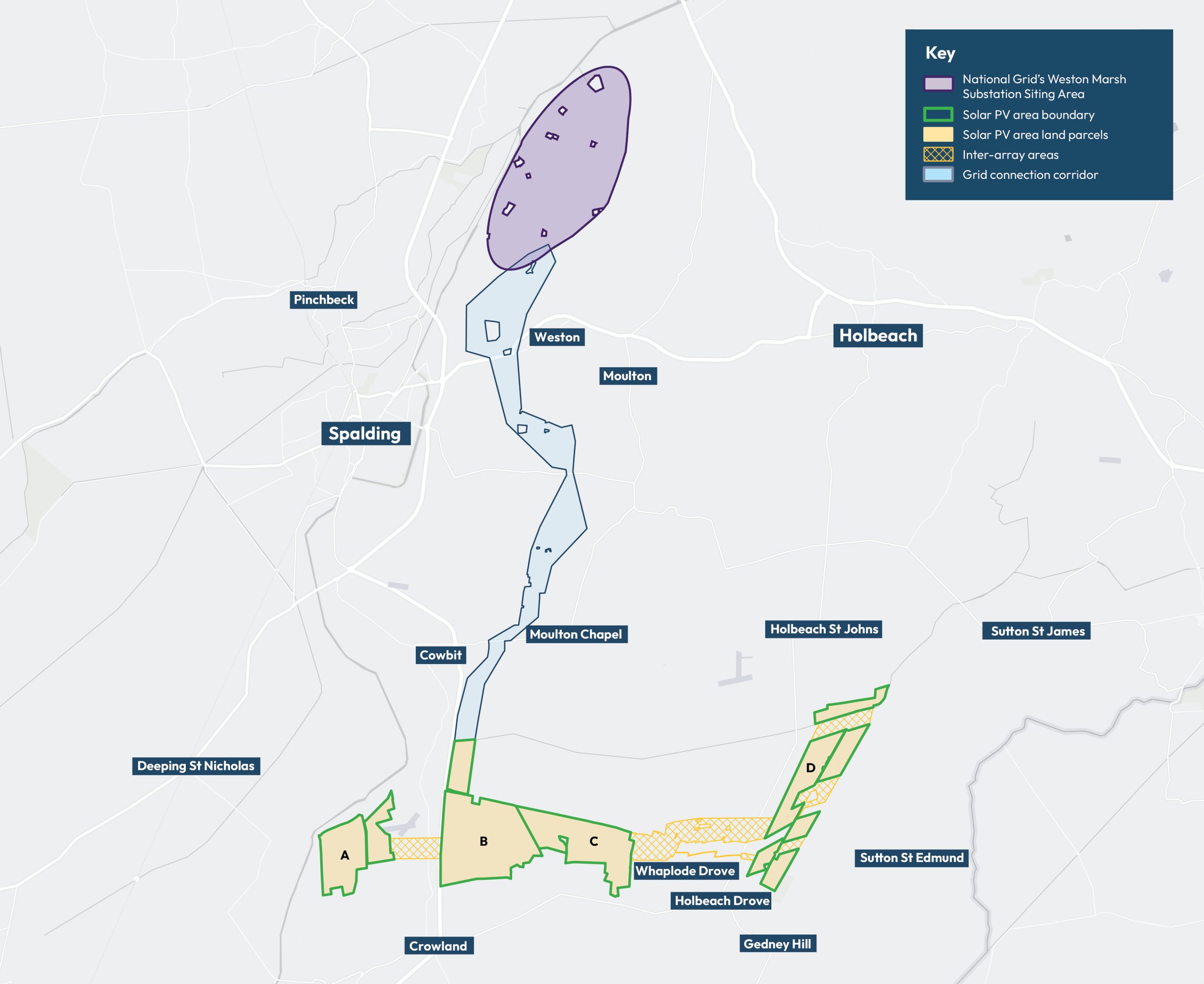
The proposals consist of photovoltaic (PV) solar panels and an approximately 12 to 13 km overhead line connection to National Grid’s planned Weston Marsh substation (due to be located east of Spalding, the exact location to be confirmed by National Grid).
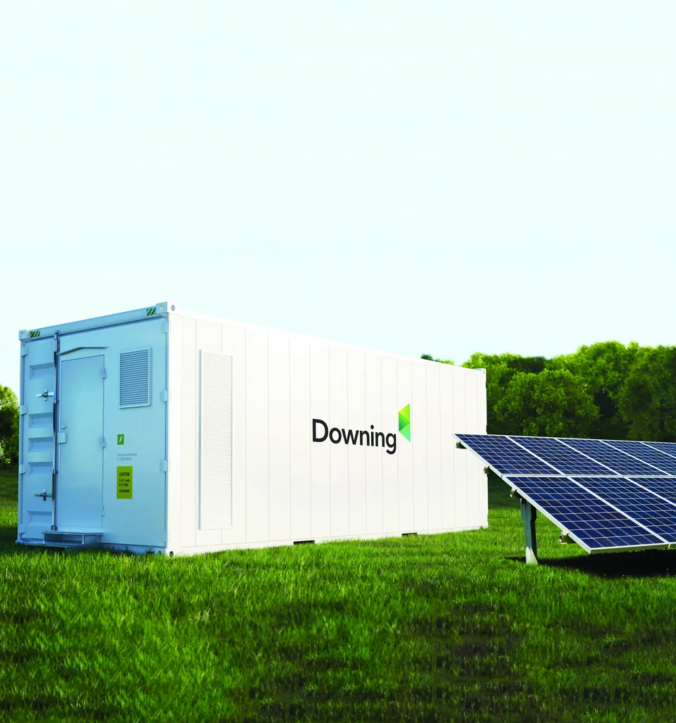
The Scheme also includes associated infrastructure, including co-located battery energy storage systems (BESS) and inter-array connections to link together the land parcels where the solar panels are located.
Interactive map
Our interactive map below allows you to search for areas of interest to you:
Our interactive map allows you view our proposals in relation to areas of interest to you. You can switch layers on and off by using the tick boxes in the Legend and find out more about specific aspects of our proposals by clicking on the various icons around the map. You can also view the number of each proposed pylon – to inform your feedback – by clicking on them in the map.
To change the base mapping, select from one of the options shown in the button on the bottoms left corner.
Why is Meridian Solar needed?
To achieve the UK government’s commitment to net zero carbon emissions by 2050, projects such as Meridian Solar are needed to help provide cleaner sources of energy. If approved, the Scheme would make a significant contribution to energy security in the UK, providing energy for up to 215,000 homes.
The energy transition will see older forms of generation phased out, such as fossil fuel power stations, and there is an urgent need for cleaner forms of generation to replace them. Solar farms such as Meridian will play a key role in meeting this need and accelerating the countries transition to net zero.
With the co-location of BESS, the Scheme will be able to provide ancillary services to help stabilise the local and national grid network. The addition of the BESS will also allow Meridian to efficiently use the solar energy, storing surplus energy at points of low demand, releasing it when needed.

Selecting our preferred connection corridor
The interactive map below shows the preferred connection corridor and indicative alignment for the overhead line. During our stage one consultation between May and July 2024, we presented two options (eastern and western) for both the northern and southern sections of the connection corridor.
Since then, we have selected the western corridors for both northern and southern sections, which forms our single preferred connection corridor. More information on how we selected the preferred connection corridor, including our site selection process to identify the four land parcels, can be found in our Consultation Information Booklet, which can be found in the Documents page.
Location
- The solar panels and associated BESS would be located within four land parcels (A, B, C and D) over an area of approximately 1,100 hectares (ha) / 2,700 acres. Approximately 600 ha (1,482 acres) of that is being considered for the solar PV panels and associated infrastructure.
- The inter-array areas are indicative areas where connection cables would link the land parcels containing solar panels together.
- The connection corridor is approximately 12 to 13 km long and will connect into National Grid’s planned Weston Marsh substation, the location to be confirmed by National Grid.
Generate renewable electricity
to support the transition to net zero and the UK’s ambition to be increasingly self-sufficient in energy
Produce clean energy
for the equivalent of approximately 215,000 homes
Provide opportunities
for local communities and the local economy
Deliver a Scheme
that enhances local ecology and achieves Biodiversity Net Gain
Work with the local community
to support community initiatives throughout the lifetime of the Scheme